

Environmental Siting & Permitting
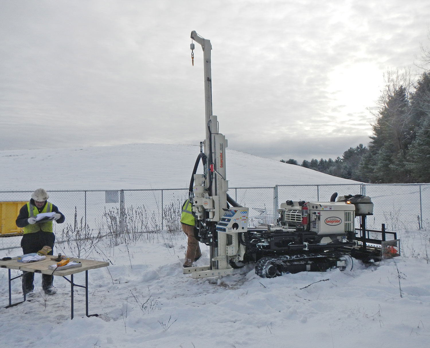
Environmental Due Diligence
APT offers due diligence services ranging from pre-acquisition environmental site assessments and constraints/opportunities analyses to feasibility studies. Our goal is to obtain a thorough understanding of a project’s potential for success by identifying the physical and regulatory limitations early in the development stage. This allows our clients to make informed decisions in a timely and efficient manner.
Conducting the appropriate level of due diligence is a critical component of projects where potential risks are a concern – meaning nearly any property transaction, development or real estate management scenario.
Regulatory Compliance & Permitting
APT assists clients with navigating local, state and federal environmental permitting compliance requirements, providing them with the expertise to make informed decisions throughout the regulatory approval process.
Perhaps of equal importance, APT promotes avoidance of permit triggers when practical through review of alternatives that satisfy project objectives while achieving or maintaining regulatory compliance.
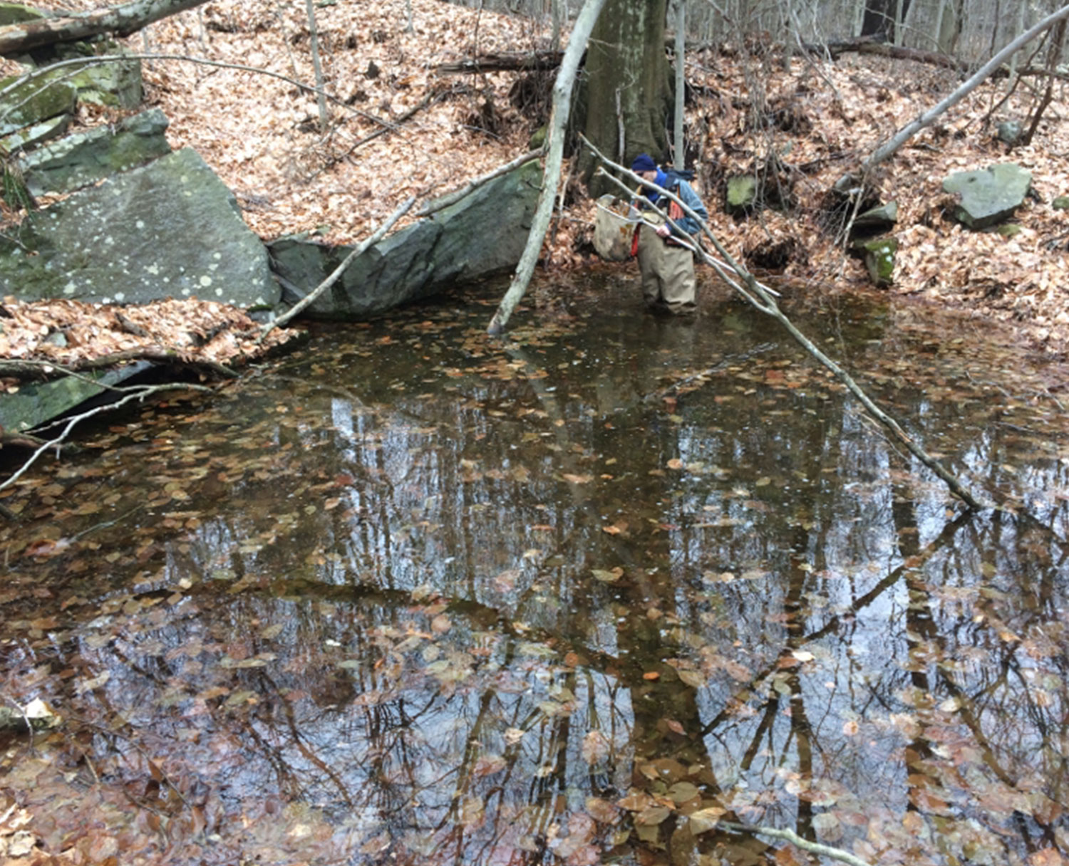
Wetlands & Natural Resources Management
Field evaluations of wetlands and wildlife include data collection and analysis using the latest in mapping technology. Field data is collected using Trimble GPS technology with sub-meter accuracy and catalogued using cloud-based software. This data is imported into ESRI ArcMap software for development of a comprehensive natural resource database for efficient review of project alternatives and assessment of resource impacts and incorporation into a variety of GIS-based map products.
Geographic Information System Services
APT uses ESRI GIS software and cutting-edge GIS technology to gather, store, analyze and display all manners of spatial data in support of projects. We routinely integrate GIS applications with GPS, AutoCAD and other technologies to create inventive solutions for our clients.
Visibility Analyses, Photo-simulations & Supporting Graphics
APT produces a wide range of visualization analyses and simulations, including precision 3D modeling, photography, photo-renderings, animation sequences, graphics and mapping. We have developed unique tools and models to predict view sheds associated with telecommunication and utility structures, wind farms, fuel cell installation, solar arrays, transportation and utility corridors, industrial and commercial developments and other small and large-scale facilities. These efforts have been incorporated with great effectiveness into public outreach, siting and regulatory permitting procedures.
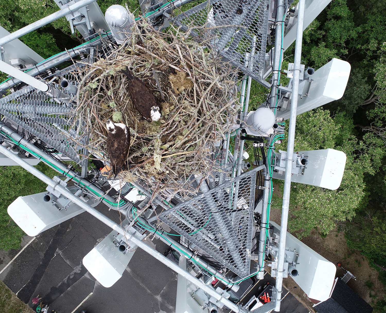
Drone Services
APT uses drones for obtaining high resolution video and/or digital photographic imagery of project sites, components, and wildlife. Our team of licensed and fully insured pilots ensures that these services comply with all Federal Aviation Administration requirements and applicable federal, state and local laws regarding the use of unmanned aerial vehicles. We specialize in conducting nest inspections, aerial imagery for visual evaluations and infrastructure assessments.
Related Projects
“Members of the APT Team have provided significant contributions and creative solutions to our project’s complex permitting challenges.”