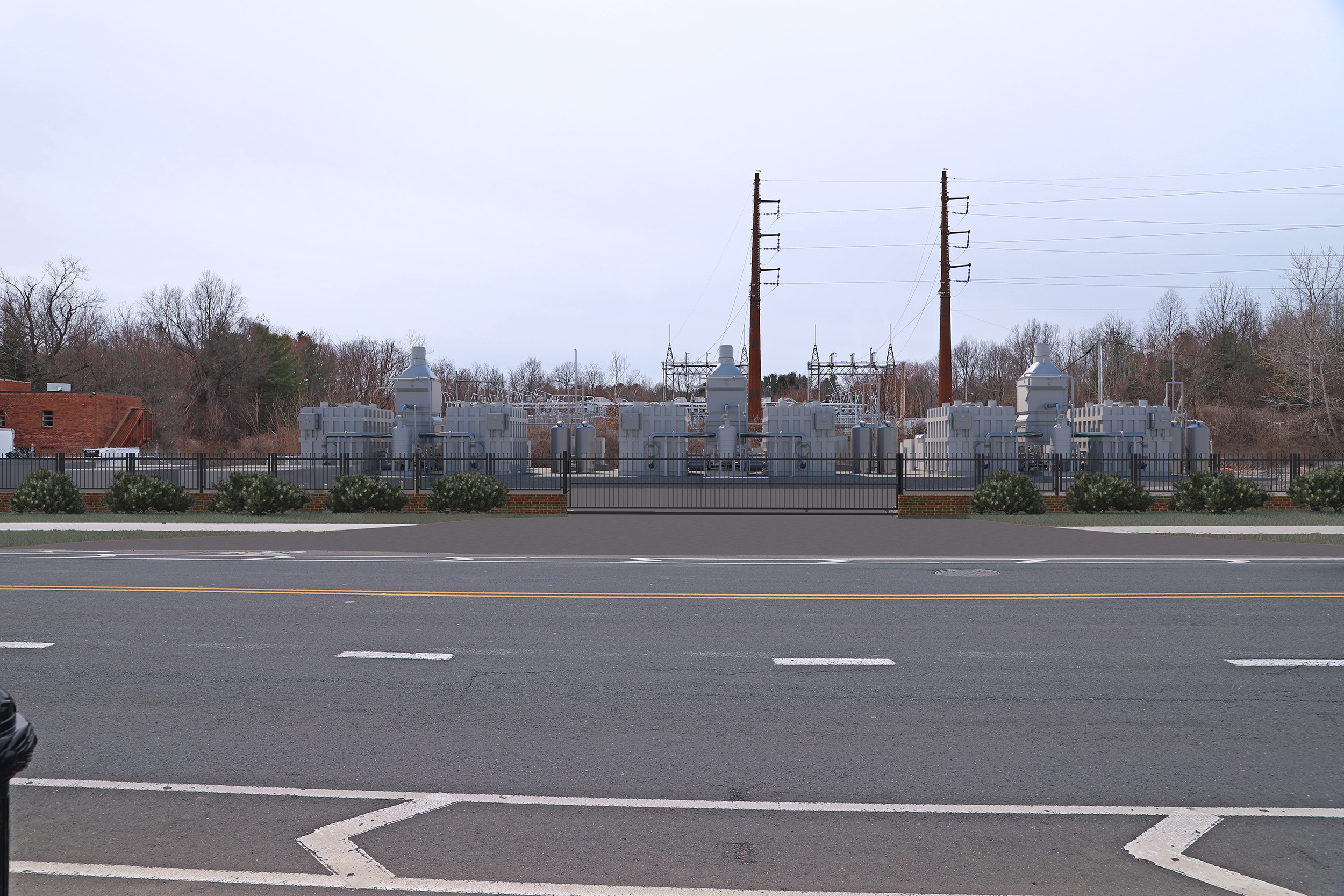
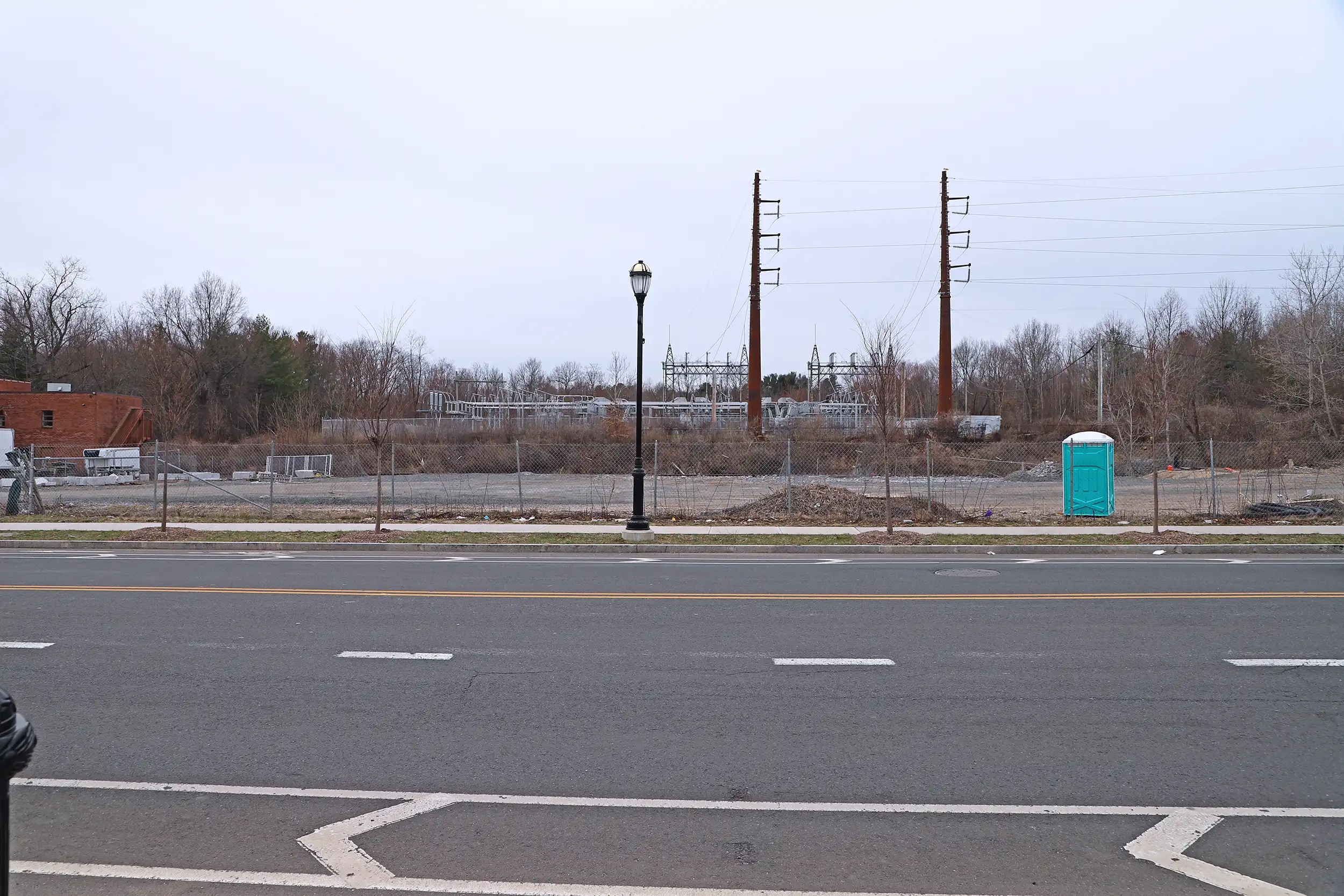
This visual simulation illustrates a proposed fuel cell installation located adjacent to an existing transmission line corridor. The imagery was prepared to depict how the new energy facility would integrate within an established utility setting, illustrating equipment scale, design elements, and spatial relationships relative to nearby transmission infrastructure.
Photographs were obtained from representative public vantage points to assess visibility within the surrounding area. The proposed fuel cell units and associated components were positioned using verified site plans and dimensional data to ensure accurate height, massing, and context. The resulting simulation provides a clear and defensible representation of anticipated visual change within the corridor environment.
Drag the handle left and right to see before and after.