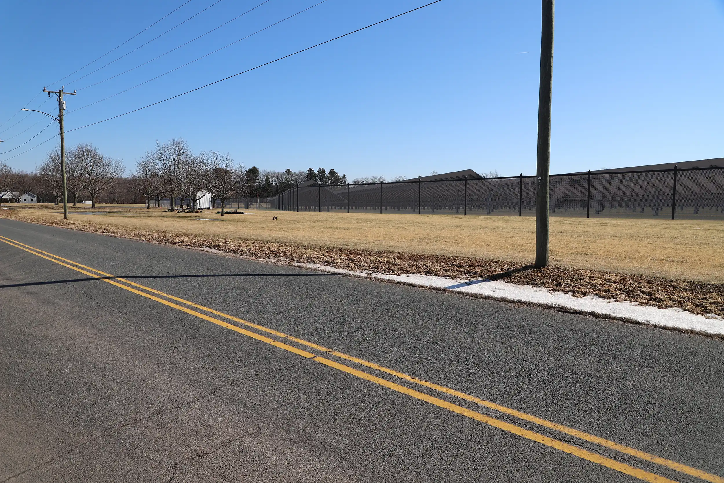
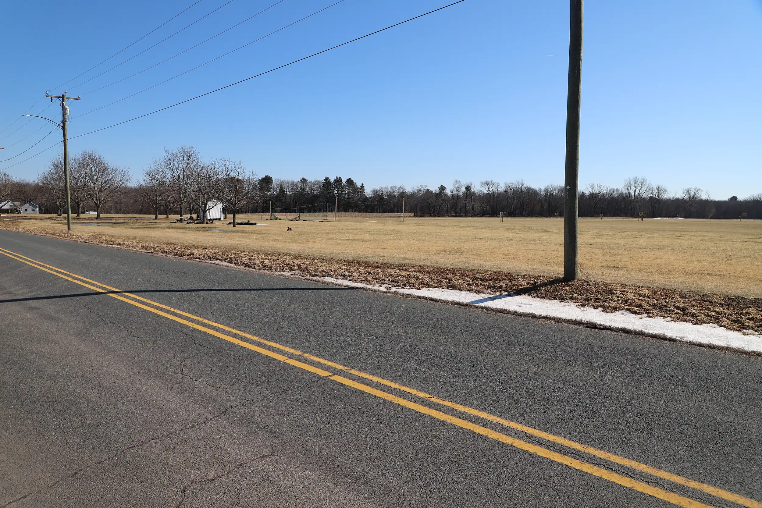
These before-and-after graphics present a comparison of a proposed solar field installation and existing conditions within a rural landscape setting. Developed to assist with environmental documentation for agency and public review, the imagery illustrates the anticipated visibility and scale of the project as it relates to the surrounding area.
Field photography was conducted from publicly accessible locations identified through viewshed analysis and site reconnaissance. Proposed solar field components were positioned using verified topographic data and project specifications to ensure dimensional accuracy. The simulation provides a realistic representation of how the facility would appear under similar viewing conditions.
Drag the handle left and right to see before and after.