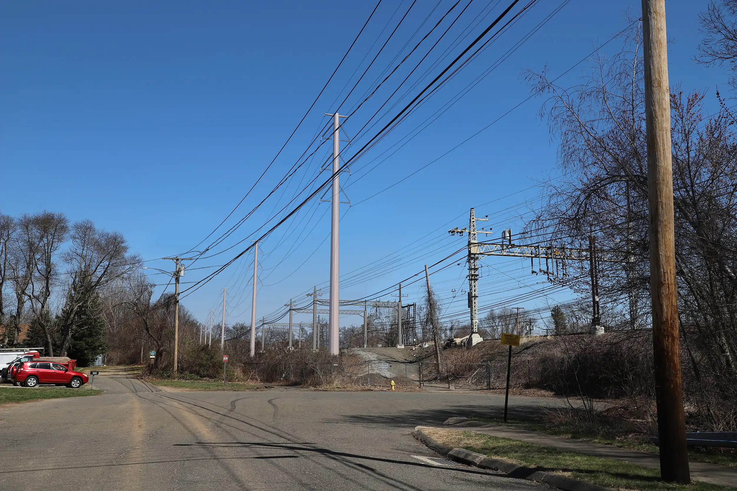
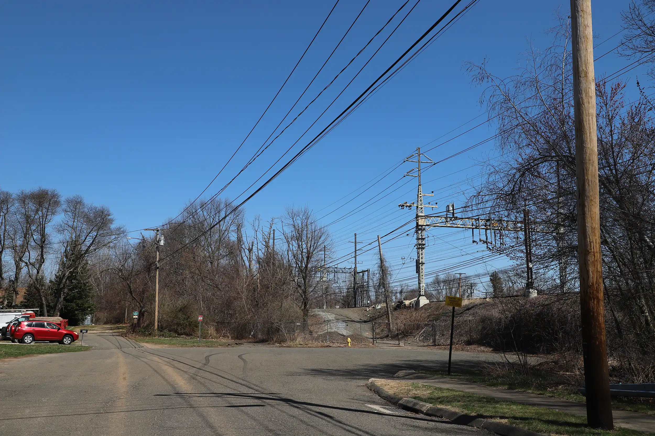
This visual simulation was developed to depict proposed utility infrastructure improvements within an existing transportation and service corridor. Prepared as part of the planning and environmental review process, the imagery illustrates anticipated visibility and spatial relationships between new infrastructure components and adjacent properties.
Source photography was obtained from representative public vantage points, and all proposed elements were modeled using survey-based measurements and engineering drawings. The resulting simulation provides an accurate depiction of height, alignment, and contextual integration within the surrounding landscape, supporting informed evaluation by agencies and stakeholders.
Drag the handle left and right to see before and after.